
One of the lovelier bike rides in the Adelaide metropolitan area is along the Sturt River.
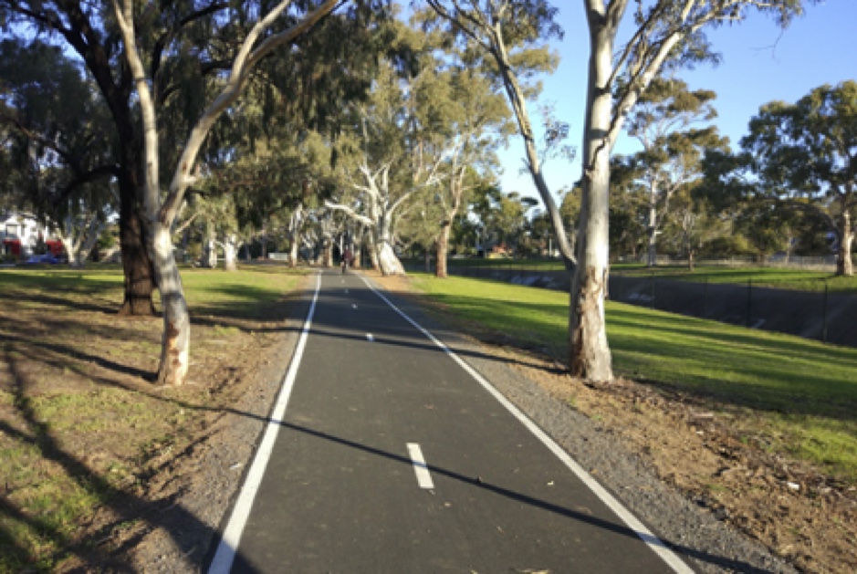
The City of Marion has recently resurfaced much of the shared use path
You can use a quiet shared use path to ride from Bedford Park (Flinders University) through Marion, crossing the Marino Rocks Greenway, on to Morphettville, Glengowrie and Glenelg, where you cross over the Mike Turtur (Tramway) Bikeway. From there the Trail continues in the City of West Torrens for a further kilometre or so to Glenelg North, touching the end of the Westside Bikeway on the way.
There it stops, at Pine Avenue, where the Sturt River becomes part of the City of Holdfast Bay. It seems Holdfast Bay has had other priorities. (We can’t complain. The Council has done a great job filling in the gap of the Coast Park at Minda.)
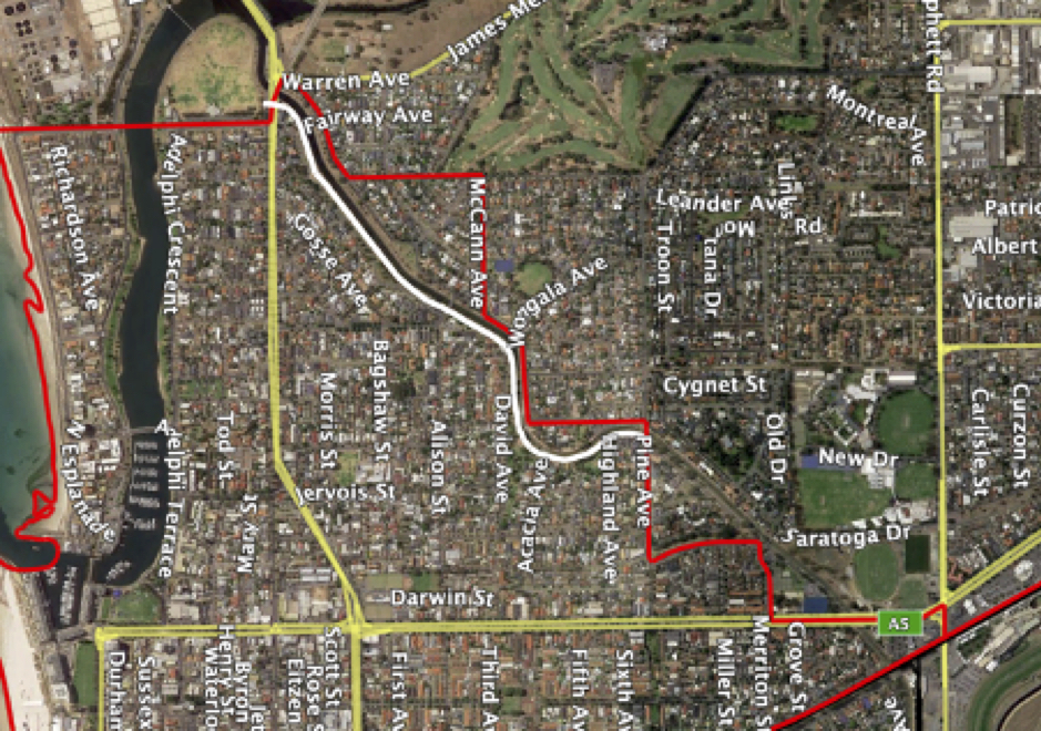
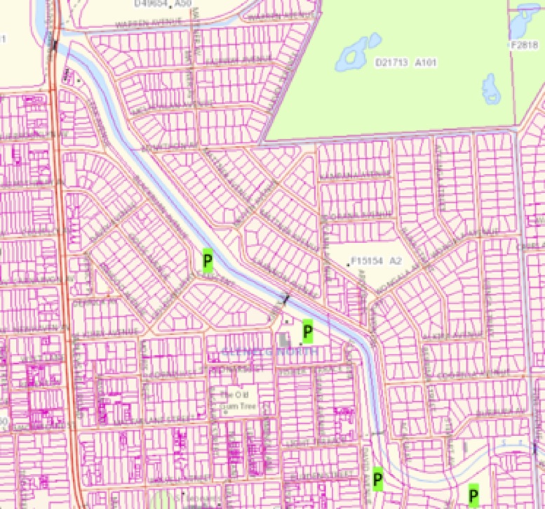
The red lines are the council boundaries. The white line indicates the bit of the path that remains to be done.
As can be seen in the map above, the Sturt River itself continues on a further 1.6km to the Patawalonga, at the end of the airport runway. The river (really a huge drain) continues to be bordered by a buffer of grass on both sides. For almost all of the 1.6km there is plenty of room for a shared use path, with only one or two squeeze points.
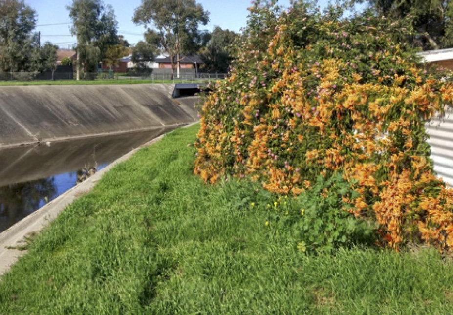
The worst squeeze point. It could be easily bypassed with a very short on-road detour if necessary.
As well as being a lovely ride and providing a good connection from the foothills to Glenelg, the Sturt River Trail provides connections to three other important “8-80” routes: the Westside Bikeway, the Mike Turtur (Glenelg Tramway) Bikeway, and the Marino Rocks Greenway.
Pleasant circular rides can be undertaken using all of these.
Extending the Trail the additional mile would also connect it to the Reece Jennings Bikeway, which skirts the southern boundary of the airport. Using an existing share use path, it would also connect to the Coast Park path, which extends for along almost all of our metropolitan beaches. Think of all the quiet riding opportunities that would add!
Extending the Trail, making the buffers alongside the River open to the public, would also provide a lot of local benefit. At the moment the land is just grass, with a few trees dotted about. Much of it is bordered by small local park. Shifting the fence from the edge of the SA Water land to the edge of the drain itself would effectively add a lot more local park space for recreation, as we see in the Marion section.
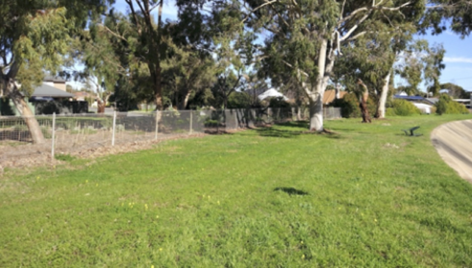
An opportunity to enlarge a local park.
While it would be lovely to see more trees along the whole 1.6km length, the map below indicates opportunities to enlarge existing local parks.
Yes, local councils are doing it tough in the Covid-19 period. But we know that the Australian government is looking for opportunities to quickly spend money to create jobs and provide a long-lasting benefit to the community. Building a shared use path, shifting a fence and local landscaping can all be done quickly.
So let’s get on with it!